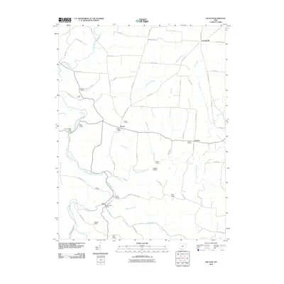
2010 Map of Decatur
USGS Topo · Published 2010About this map
Decatur and the surrounding Brown County landscape are defined by a complex network of waterways, where the West Fork Eagle Creek and East Fork Eagle Creek converge near Neel. This 2010 survey illustrates the deep-rooted rural character of the region, anchored by the Decatur Post Office and several small community centers like Eckmansville and Fairview. The terrain is marked by numerous named valleys and ridges, including Decan Hollow and Hickory Ridge, which have long shaped local travel and settlement patterns. Genealogists will find significant value in the distribution of family and community burial grounds, such as Liberty Chapel Cemetery and Bissinger Cemetery. The map also preserves the memory of early transportation infrastructure, most notably the Narrow Gauge Rd in the north and the structural landmark of the Eagle Creek Bridge.
Find a feature on this map
71 named features on this map. Tap any name to fly to it.
Don’t see what you’re looking for? This feature index may not catch every label — zoom into the map to look around manually.
Map Details
Editions of this 2010 Decatur Map
This is the sole edition of this map. No revisions or reprints were ever made.
Other maps of this area

1915 · Maysville
USGS Topo · 1:62,500

1918 · Seaman
USGS Topo · 1:62,500

1919 · Maysville
USGS Topo · 1:62,500

1928 · Higginsport
USGS Topo · 1:48,000

1929 · Springdale
USGS Topo · 1:48,000

1931 · Higginsport
USGS Topo · 1:62,500

1935 · Springdale
USGS Topo · 1:62,500

1952 · Maysville East
USGS Topo · 1:24,000

1952 · Maysville West
USGS Topo · 1:24,000
1952 · Manchester Islands
USGS Topo · 1:24,000