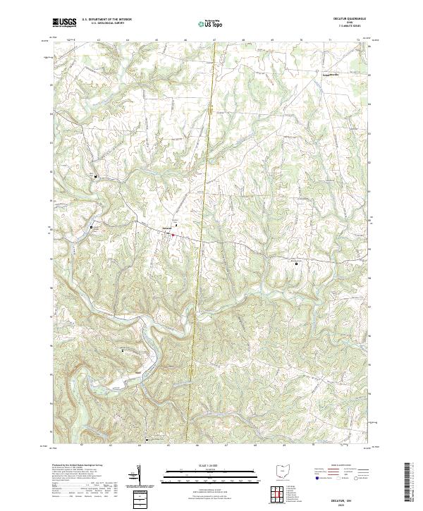
2023 Map of Decatur
USGS Topo · Published 2023About this map
The boundary between Brown and Adams counties runs directly through the center of this landscape, bisecting the settlement of Decatur. This rural region is defined by a dense network of winding creeks and branches that have carved numerous hollows into the terrain, such as Decan Hollow and Kirker Hollow. The topography is particularly intricate along the West Fork Eagle Creek and its various tributaries like Rattlesnake Creek and Wild Duck Branch.
Find a feature on this map
94 named features on this map. Tap any name to fly to it.
Don’t see what you’re looking for? This feature index may not catch every label — zoom into the map to look around manually.
Map Details
Editions of this 2023 Decatur Map
This is the sole edition of this map. No revisions or reprints were ever made.
Other maps of this area

1915 · Maysville
USGS Topo · 1:62,500

1918 · Seaman
USGS Topo · 1:62,500

1919 · Maysville
USGS Topo · 1:62,500

1928 · Higginsport
USGS Topo · 1:48,000

1929 · Springdale
USGS Topo · 1:48,000

1931 · Higginsport
USGS Topo · 1:62,500

1935 · Springdale
USGS Topo · 1:62,500

1952 · Maysville East
USGS Topo · 1:24,000

1952 · Maysville West
USGS Topo · 1:24,000
1952 · Manchester Islands
USGS Topo · 1:24,000