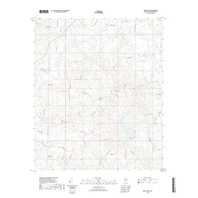
2018 Map of Decatur NW
USGS Topo · Published 2018About this map
The town of Decatur sits at the eastern edge of this landscape, where the headwaters of several critical watercourses define the local topography. The area is marked by a complex network of streams and creeks, including Conehatta Cr and Okohatta Cr, which drain through the timber-rich terrain of Newton County. Significant water features such as Spring Lake and County Pond provide local landmarks among the winding routes of Decatur Conehatta Rd and Pine Bluff Rd. For those researching local family histories, the presence of Hollingsworth Cem and Bufkin Cem offers specific points of interest within the rural landscape. The settlement of Jeff appears to the southeast, situated near the intersection of Turkey Creek Rd and Holly Rd, reflecting the dispersed nature of late-20th-century Mississippi rural communities.
Find a feature on this map
69 named features on this map. Tap any name to fly to it.
Don’t see what you’re looking for? This feature index may not catch every label — zoom into the map to look around manually.
Map Details
Editions of this 2018 Decatur NW Map
This is the sole edition of this map. No revisions or reprints were ever made.
Other maps of this area

1921 · Forest
USGS Topo · 1:48,000

1922 · Forest
USGS Topo · 1:62,500

1950 · Forest
USGS Topo · 1:62,500

1952 · Forest
USGS Topo · 1:62,500

1953 · Meridian
USGS Topo · 1:250,000

1957 · Meridian
USGS Topo · 1:250,000

1965 · Meridian
USGS Topo · 1:250,000

1966 · Hickory
USGS Topo · 1:24,000

1966 · Newton
USGS Topo · 1:24,000

1966 · Decatur NW
USGS Topo · 1:24,000