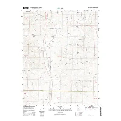
2015 Map of Decaturville
USGS Topo · Published 2015About this map
The Decaturville landscape in Camden County is defined by a dense network of hollows and creek beds, most notably the winding path of Dry Auglaize Cr. This 2015 survey reveals a terrain carved by history and geology, where family names are etched into the land at sites like Stone Cemetery, Garrison Cemetery, and Wheeler Cemetery. The area south of Camdenton shows a distinct transition from the aviation activity at Camdenton Memorial Airport to the deep-set drainage patterns of Morgan Hollow and Pettijohn Hollow. Prominent topographical features like the Devils Backbone provide natural landmarks for navigating the ridges above Forbes Br and Prairie Br. The map's layout captures a rural Missouri corridor where modern roads like Mo-V intersect with older settlement patterns near Hugo and the crossing of the Laclede County line.
Find a feature on this map
114 named features on this map. Tap any name to fly to it.
Don’t see what you’re looking for? This feature index may not catch every label — zoom into the map to look around manually.
Map Details
Editions of this 2015 Decaturville Map
This is the sole edition of this map. No revisions or reprints were ever made.
Other maps of this area

1888 · Versailles
USGS Topo · 1:125,000

1893 · Versailles
USGS Topo · 1:125,000

1932 · Versailles No 4
USGS Topo · 1:48,000

1933 · Stoutland
USGS Topo · 1:62,500

1934 · Macks Creek
USGS Topo · 1:48,000

1934 · Camdenton
USGS Topo · 1:24,000

1934 · Toronto
USGS Topo · 1:24,000

1934 · Green Bay Terrace
USGS Topo · 1:24,000

1938 · Stoutland
USGS Topo · 1:62,500

1939 · Macks Creek
USGS Topo · 1:62,500