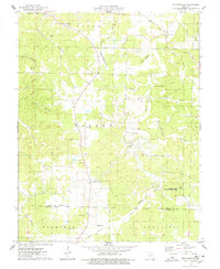
1975 Map of Decaturville
USGS Topo · Published 1978About this map
Decaturville serves as a central hub in this Ozark plateau landscape, where the transition from the rolling highlands of Warren and Auglaize townships meet the northern edge of Eldridge. The terrain is deeply incised by a network of seasonal and permanent waterways, including Osage Fork, North Fork, and the meandering Dry Auglaize Creek. A distinct pattern of local genealogy and community history is visible through the numerous family and community landmarks, such as Stone Cem, Wheeler Cem, and Mt Horeb Ch.
Find a feature on this map
43 named features on this map. Tap any name to fly to it.
Don’t see what you’re looking for? This feature index may not catch every label — zoom into the map to look around manually.
Map Details
Editions of this 1975 Decaturville Map
This is the sole edition of this map. No revisions or reprints were ever made.
Other maps of this area

1888 · Versailles
USGS Topo · 1:125,000

1893 · Versailles
USGS Topo · 1:125,000

1932 · Versailles No 4
USGS Topo · 1:48,000

1933 · Stoutland
USGS Topo · 1:62,500

1934 · Macks Creek
USGS Topo · 1:48,000

1934 · Camdenton
USGS Topo · 1:24,000

1934 · Toronto
USGS Topo · 1:24,000

1934 · Green Bay Terrace
USGS Topo · 1:24,000

1938 · Stoutland
USGS Topo · 1:62,500

1939 · Macks Creek
USGS Topo · 1:62,500