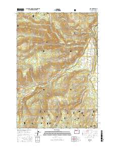
2017 Map of Dee
USGS Topo · Published 2017About this map
The confluence of the West Fork Hood River and East Fork Hood River serves as the focal point for this section of Mount Hood National Forest, where the settlement of Dee and the adjacent Dee Flat occupy the valley floor. This 2017 study details an intricate hydraulic landscape, from the high Japanese Springs and Crystal Springs to the engineered Oak Grove Ditch and Searra Casa Reservoir. The geography is defined by prominent elevations such as Blowdown Ridge and Trout Creek Ridge, which separate the various drainages feeding into the Upper Hood River Valley.
Find a feature on this map
64 named features on this map. Tap any name to fly to it.
Don’t see what you’re looking for? This feature index may not catch every label — zoom into the map to look around manually.
Map Details
Editions of this 2017 Dee Map
This is the sole edition of this map. No revisions or reprints were ever made.
Other maps of this area

1924 · Mount Hood
USGS Topo · 1:125,000

1926 · Hood River
USGS Topo · 1:125,000

1927 · Mount Hood
USGS Topo · 1:125,000

1929 · Hood River
USGS Topo · 1:125,000

1953 · The Dalles
USGS Topo · 1:250,000

1956 · The Dalles
USGS Topo · 1:250,000

1957 · The Dalles
USGS Topo · 1:250,000

1957 · Bonneville Dam
USGS Topo · 1:62,500

1957 · Hood River
USGS Topo · 1:62,500

1962 · Cathedral Ridge
USGS Topo · 1:24,000