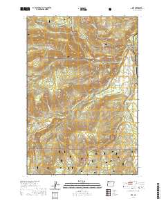
2020 Map of Dee
USGS Topo · Published 2020About this map
The West Fork Hood River and East Fork Hood River converge near the settlement of Dee, marking a landscape defined by hydraulic engineering and timbered slopes. This 2020 survey highlights the intricate water management system of the Upper Hood River Valley, featuring the Oak Grove Ditch and the Searra Casa Reservoir. The map provides a precise look at the modern boundaries of the Mount Hood National Forest, where topographic features like Blowdown Ridge and Trout Creek Ridge rise above the river valleys.
Find a feature on this map
62 named features on this map. Tap any name to fly to it.
Don’t see what you’re looking for? This feature index may not catch every label — zoom into the map to look around manually.
Map Details
Editions of this 2020 Dee Map
This is the sole edition of this map. No revisions or reprints were ever made.
Other maps of this area

1924 · Mount Hood
USGS Topo · 1:125,000

1926 · Hood River
USGS Topo · 1:125,000

1927 · Mount Hood
USGS Topo · 1:125,000

1929 · Hood River
USGS Topo · 1:125,000

1953 · The Dalles
USGS Topo · 1:250,000

1956 · The Dalles
USGS Topo · 1:250,000

1957 · The Dalles
USGS Topo · 1:250,000

1957 · Bonneville Dam
USGS Topo · 1:62,500

1957 · Hood River
USGS Topo · 1:62,500

1962 · Cathedral Ridge
USGS Topo · 1:24,000