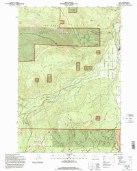
1994 Map of Dee
USGS Topo · Published 1996About this map
The confluence of the three forks of the West Fork Hood River, Middle Fork Hood River, and East Fork Hood River anchors this mid-1990s look at the timber and water resources of Hood River County. The settlement of Dee serves as a central hub for the surrounding Mt Hood Nat For, where steep drainage patterns are defined by Green Point Creek and the notable Punchbowl Falls. Local infrastructure is concentrated in the east, featuring a Fish Hatchery, a Gaging Station, and the Winans settlement along the riverbanks.
Find a feature on this map
48 named features on this map. Tap any name to fly to it.
Don’t see what you’re looking for? This feature index may not catch every label — zoom into the map to look around manually.
Map Details
Editions of this 1994 Dee Map
This is the sole edition of this map. No revisions or reprints were ever made.
Other maps of this area

1924 · Mount Hood
USGS Topo · 1:125,000

1926 · Hood River
USGS Topo · 1:125,000

1927 · Mount Hood
USGS Topo · 1:125,000

1929 · Hood River
USGS Topo · 1:125,000

1953 · The Dalles
USGS Topo · 1:250,000

1956 · The Dalles
USGS Topo · 1:250,000

1957 · The Dalles
USGS Topo · 1:250,000

1957 · Bonneville Dam
USGS Topo · 1:62,500

1957 · Hood River
USGS Topo · 1:62,500

1962 · Cathedral Ridge
USGS Topo · 1:24,000