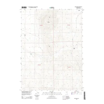
2014 Map of Deep Creek
USGS Topo · Published 2014About this map
Wilson Peak towers over the high-desert landscape of Elko County, anchoring the northern reaches of the Bull Run Mountains. This area is defined by its dramatic elevation changes and a network of drainages that support sparse mountain life, including Sulphur Cr and Chicken Cr. The settlement of Deep Creek sits along the eastern edge of the quadrangle, serving as a landmark in a territory largely characterized by deep canyons and mountain ridges.
Find a feature on this map
24 named features on this map. Tap any name to fly to it.
Don’t see what you’re looking for? This feature index may not catch every label — zoom into the map to look around manually.
Map Details
Editions of this 2014 Deep Creek Map
This is the sole edition of this map. No revisions or reprints were ever made.
Other maps of this area

1955 · McDermitt
USGS Topo · 1:250,000

1956 · Tuscarora
USGS Topo · 1:62,500

1956 · Mt. Blitzen
USGS Topo · 1:62,500

1956 · Bull Run
USGS Topo · 1:62,500

1959 · McDermitt
USGS Topo · 1:250,000

1964 · Wilson Reservoir
USGS Topo · 1:62,500

1982 · Bull Run Mts
USGS Topo · 1:100,000

1982 · Tuscarora
USGS Topo · 1:100,000
1987 · Cottonwood Peak
USGS Topo · 1:24,000
1987 · Big Cottonwood Canyon
USGS Topo · 1:24,000