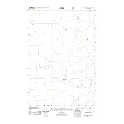
2011 Map of Deep Creek South
USGS Topo · Published 2011About this map
Deep Creek winds through this section of the North Dakota badlands, carving a path through the open ranching country of Slope County. The landscape is defined by wide grazing lands and the isolated prominence of Round Top Butte, which provides a distinct landmark in an area otherwise characterized by sweeping plains and coulees. Ranching remains the primary footprint on this terrain, with established homesteads such as the HT Ranch, R Bergquist Ranch, and R Staber Ranch anchoring the local geography. Transportation is limited to a sparse network of section-line roads and unimproved tracks, including E Rhame Rd, which connects these remote operations. This 2011 survey illustrates the continued reliance on the natural drainage of the creek and the enduring cattle-ranching traditions of the northern plains.
Find a feature on this map
26 named features on this map. Tap any name to fly to it.
Don’t see what you’re looking for? This feature index may not catch every label — zoom into the map to look around manually.
Map Details
Editions of this 2011 Deep Creek South Map
This is the sole edition of this map. No revisions or reprints were ever made.
Other maps of this area

1953 · Dickinson
USGS Topo · 1:250,000

1957 · Dickinson
USGS Topo · 1:250,000

1961 · Rocky Ridge
USGS Topo · 1:62,500

1973 · Black Butte
USGS Topo · 1:24,000

1973 · Stewart Lake
USGS Topo · 1:24,000

1979 · Deep Creek North
USGS Topo · 1:24,000

1979 · Ives
USGS Topo · 1:24,000

1980 · Spring Creek
USGS Topo · 1:24,000

1980 · Belfield
USGS Topo · 1:100,000

1981 · Bowman
USGS Topo · 1:100,000