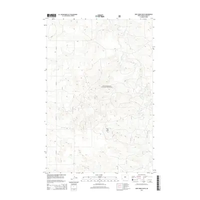
2014 Map of Deep Creek South
USGS Topo · Published 2014About this map
Little Missouri National Grassland dominates this portion of Slope County, showing a landscape defined by drainage patterns and isolation. The land is marked by the winding course of Deep Cr, which snakes through the eastern half of the map, and the prominent elevation of Round Top Butte to the south. This area is characterized by vast open spaces and limited infrastructure, with E Rhame Rd serving as one of the few primary access points through the terrain. The presence of numerous numbered forest service routes, such as 79210 and 7931, suggests a region managed for public land use and grazing rather than dense settlement. For those studying the geography of the North Dakota badlands, the contour intervals reveal the intricate draws and ridges that feed into the local creek systems.
Find a feature on this map
24 named features on this map. Tap any name to fly to it.
Don’t see what you’re looking for? This feature index may not catch every label — zoom into the map to look around manually.
Map Details
Editions of this 2014 Deep Creek South Map
This is the sole edition of this map. No revisions or reprints were ever made.
Other maps of this area

1953 · Dickinson
USGS Topo · 1:250,000

1957 · Dickinson
USGS Topo · 1:250,000

1961 · Rocky Ridge
USGS Topo · 1:62,500

1973 · Black Butte
USGS Topo · 1:24,000

1973 · Stewart Lake
USGS Topo · 1:24,000

1979 · Deep Creek North
USGS Topo · 1:24,000

1979 · Ives
USGS Topo · 1:24,000

1980 · Spring Creek
USGS Topo · 1:24,000

1980 · Belfield
USGS Topo · 1:100,000

1981 · Bowman
USGS Topo · 1:100,000