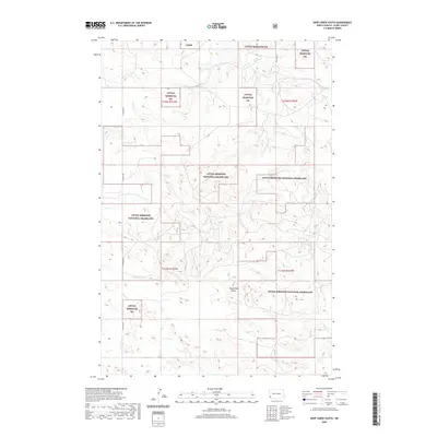
2020 Map of Deep Creek South
USGS Topo · Published 2020About this map
Little Missouri National Grassland dominates this landscape in Slope County, North Dakota, where the topography of the Badlands is defined by significant elevation changes and drainage networks. The meandering course of Deep Cr carves through the terrain, while prominent landmarks like Round Top Butte provide clear navigational reference points in the open country. This modern survey illustrates the complex boundaries between public lands and township divisions, including Little Missouri NG T135N R103W and t134n r102w. Transportation is limited to a sparse grid of rural routes, notably E Rhame Rd and 152nd Ave Sw, which serve the agricultural and ranching interests that have long characterized this region. The map preserves the specific administrative divisions of the Lmng and larger national grassland tracts as they existed in the early twenty-first century.
Find a feature on this map
11 named features on this map. Tap any name to fly to it.
Don’t see what you’re looking for? This feature index may not catch every label — zoom into the map to look around manually.
Map Details
Editions of this 2020 Deep Creek South Map
This is the sole edition of this map. No revisions or reprints were ever made.
Other maps of this area

1953 · Dickinson
USGS Topo · 1:250,000

1957 · Dickinson
USGS Topo · 1:250,000

1961 · Rocky Ridge
USGS Topo · 1:62,500

1973 · Black Butte
USGS Topo · 1:24,000

1973 · Stewart Lake
USGS Topo · 1:24,000

1979 · Deep Creek North
USGS Topo · 1:24,000

1979 · Ives
USGS Topo · 1:24,000

1980 · Spring Creek
USGS Topo · 1:24,000

1980 · Belfield
USGS Topo · 1:100,000

1981 · Bowman
USGS Topo · 1:100,000