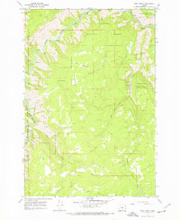
1967 Map of Deep Creek
USGS Topo · Published 1972About this map
The Grande Ronde River carves a deep path through this corner of northeast Oregon, marking the boundary between the Umatilla National Forest and the Wallowa National Forest. This 1967 survey captures a remote landscape defined by steep drainages and upland clearings, where access is limited to a network of trails and jeep trails. The boundary between Union and Wallowa counties follows the river's winding course, while numerous smaller waterways like Deep Creek, Clear Creek, and Alder Creek feed the main channel.
Find a feature on this map
16 named features on this map. Tap any name to fly to it.
Don’t see what you’re looking for? This feature index may not catch every label — zoom into the map to look around manually.
Map Details
Editions of this 1967 Deep Creek Map
3 editions found
Other maps of this area

1955 · Grangeville
USGS Topo · 1:250,000

1959 · Grangeville
USGS Topo · 1:250,000

1964 · Howard Butte
USGS Topo · 1:24,000

1964 · Akers Butte
USGS Topo · 1:24,000

1964 · Rondowa
USGS Topo · 1:24,000

1967 · Fry Meadow
USGS Topo · 1:24,000

1967 · Eden
USGS Topo · 1:24,000

1967 · Elbow Creek
USGS Topo · 1:24,000

1967 · Promise
USGS Topo · 1:24,000
1967 · Deep Creek
USGS Topo · 1:24,000