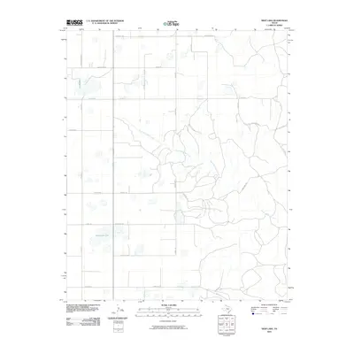
2010 Map of Deep Lake
USGS Topo · Published 2010About this map
North McClellan Creek winds through this section of the Texas Panhandle, carving a drainage pattern across a landscape otherwise defined by a rigid grid of rural roads. The area is characterized by scattered surface water, notably at Wakefield Lake, and numerous small, unnamed ponds and depressions typical of the high plains. A complex network of local routes, including Couts Thomas Rd, English Rd, and Gray Bros Rd, reveals the family-named landmarks and ranching history of Gray County. The infrastructure is centered on agricultural access, with major state-maintained arteries like Farm Rd 293 and Ranch Rd 749 connecting these isolated holdings. This 2010 edition by the U.S. Geological Survey provides a detailed view of the terrain before modern developments might have altered the traditional rural boundaries.
Find a feature on this map
26 named features on this map. Tap any name to fly to it.
Don’t see what you’re looking for? This feature index may not catch every label — zoom into the map to look around manually.
Map Details
Editions of this 2010 Deep Lake Map
This is the sole edition of this map. No revisions or reprints were ever made.
Other maps of this area

1954 · Amarillo
USGS Topo · 1:250,000

1958 · Amarillo
USGS Topo · 1:250,000

1960 · Groom
USGS Topo · 1:62,500

1964 · Jericho
USGS Topo · 1:24,000

1964 · Rockledge
USGS Topo · 1:24,000

1966 · Grandview School
USGS Topo · 1:24,000

1966 · Kingsmill
USGS Topo · 1:24,000

1966 · Bowers City
USGS Topo · 1:24,000

1967 · Lefors
USGS Topo · 1:24,000

1968 · Taylor Ranch
USGS Topo · 1:24,000