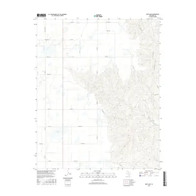
2016 Map of Deep Lake
USGS Topo · Published 2016About this map
The High Plains of the Texas Panhandle define this landscape in Gray County, where the hydrology of the North McClellan Creek system carves into the tableland. Isolated water bodies like Deep Lake and Wakefield Lake serve as vital landmarks in an area dominated by ranching and large-scale land management. The presence of the Taylor Ranch Hq and a network of named roads, including Couts Thomas Rd and McCracken Rd, illustrates the intersection of family-held territories and the public transit grid. The drainage pattern of N McClellan Cr creates significant relief in the eastern portion of the quadrangle, contrasting with the level agricultural and grazing lands found further west toward Ritter Rd. This 2016 survey documents the enduring pastoral infrastructure of the region through its carefully marked farm-to-market routes and ranch headquarters.
Find a feature on this map
32 named features on this map. Tap any name to fly to it.
Don’t see what you’re looking for? This feature index may not catch every label — zoom into the map to look around manually.
Map Details
Editions of this 2016 Deep Lake Map
This is the sole edition of this map. No revisions or reprints were ever made.
Other maps of this area

1954 · Amarillo
USGS Topo · 1:250,000

1958 · Amarillo
USGS Topo · 1:250,000

1960 · Groom
USGS Topo · 1:62,500

1964 · Jericho
USGS Topo · 1:24,000

1964 · Rockledge
USGS Topo · 1:24,000

1966 · Grandview School
USGS Topo · 1:24,000

1966 · Kingsmill
USGS Topo · 1:24,000

1966 · Bowers City
USGS Topo · 1:24,000

1967 · Lefors
USGS Topo · 1:24,000

1968 · Taylor Ranch
USGS Topo · 1:24,000