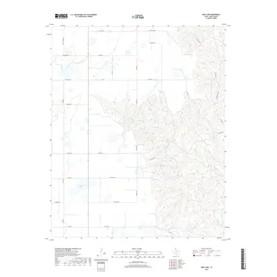
2019 Map of Deep Lake
USGS Topo · Published 2019About this map
Wakefield Lake and the branching drainage of North McClellan Creek define the landscape of this portion of Gray County. This 2019 survey by the U.S. Geological Survey captures a ranching-focused terrain characterized by a dense network of local roads named for prominent families and ranching operations. The topography transitions from the flatter plains in the west, where Deep Lake Rd and Baggerman Rd intersect, to the complex ravine systems of the N-McClellan Cr to the east. For those studying local land ownership and the evolution of Texas Panhandle ranching, the map identifies landmarks like the Taylor Ranch HQ and indicates the routes of modern transportation corridors such as Farm Rd 2477 and Farm Rd 293 as they navigate the breaks of the Red River watershed.
Find a feature on this map
31 named features on this map. Tap any name to fly to it.
Don’t see what you’re looking for? This feature index may not catch every label — zoom into the map to look around manually.
Map Details
Editions of this 2019 Deep Lake Map
This is the sole edition of this map. No revisions or reprints were ever made.
Other maps of this area

1954 · Amarillo
USGS Topo · 1:250,000

1958 · Amarillo
USGS Topo · 1:250,000

1960 · Groom
USGS Topo · 1:62,500

1964 · Jericho
USGS Topo · 1:24,000

1964 · Rockledge
USGS Topo · 1:24,000

1966 · Grandview School
USGS Topo · 1:24,000

1966 · Kingsmill
USGS Topo · 1:24,000

1966 · Bowers City
USGS Topo · 1:24,000

1967 · Lefors
USGS Topo · 1:24,000

1968 · Taylor Ranch
USGS Topo · 1:24,000