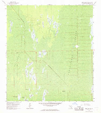
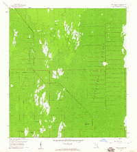
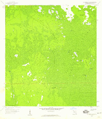
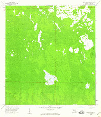
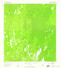
1959 Map of Deep Lake SW
USGS Topo · Published 1968About this map
The Fakahatchee Strand and Picayune Strand dominate this 1959 topographic survey of southern Florida, revealing a landscape defined by expansive wetlands and seasonal prairies. The terrain is marked by dozens of named grassy openings including Twelvemile Prairie, Dollar Prairie, and the curiously named Starvation Prairie. These features provide a detailed look at the hydrology of the Big Cypress region before extensive modern development.
Find a feature on this map
28 named features on this map. Tap any name to fly to it.
Don’t see what you’re looking for? This feature index may not catch every label — zoom into the map to look around manually.
Map Details
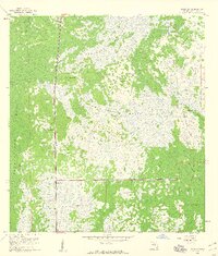
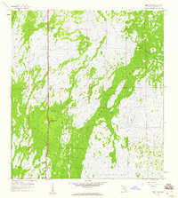
Editions of this 1959 Deep Lake SW Map
3 editions found

Other maps of this area

1956 · Miami
USGS Topo · 1:250,000

1956 · West Palm Beach
USGS Topo · 1:250,000

1957 · West Palm Beach
USGS Topo · 1:250,000

1958 · West Palm Beach
USGS Topo · 1:250,000

1958 · Miami
USGS Topo · 1:250,000
1958 · Catherine Island
USGS Topo · 1:24,000
1958 · Belle Meade NE
USGS Topo · 1:24,000
1958 · Belle Meade SE
USGS Topo · 1:24,000
1959 · Miles City
USGS Topo · 1:24,000
1959 · Deep Lake
USGS Topo · 1:24,000