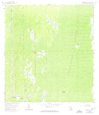
1959 Map of Deep Lake SW
USGS Topo · Published 1974About this map
Fakahatchee Strand and Picayune Strand dominate this section of the Florida Everglades, revealing a landscape defined by seasonal water and cypress systems during the mid-20th century. The presence of an Old Railroad Grade cutting horizontally across the terrain points to the earlier logging operations that once accessed these remote areas before they were preserved. The map is exceptionally detailed regarding named open spaces within the swamp, including locally identified spots like Pretty Island, Royal Palm Hammock, and Dan House Prairie. These named prairies, such as Starvation Prairie and Twelvemile Prairie, highlight the importance of slight elevation changes and vegetation patterns for navigation and historical land use in Collier County. Topographic data from 1959 is supplemented by 1973 aerial photography revisions, showing the precise boundaries of North Swan Prairie and Slate Prairie before modern environmental shifts.
Find a feature on this map
26 named features on this map. Tap any name to fly to it.
Don’t see what you’re looking for? This feature index may not catch every label — zoom into the map to look around manually.
Map Details
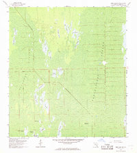
Editions of this 1959 Deep Lake SW Map
3 editions found

Other maps of this area

1956 · Miami
USGS Topo · 1:250,000

1956 · West Palm Beach
USGS Topo · 1:250,000

1957 · West Palm Beach
USGS Topo · 1:250,000

1958 · West Palm Beach
USGS Topo · 1:250,000

1958 · Miami
USGS Topo · 1:250,000

1958 · Catherine Island
USGS Topo · 1:24,000

1958 · Belle Meade NE
USGS Topo · 1:24,000

1958 · Belle Meade SE
USGS Topo · 1:24,000

1959 · Miles City
USGS Topo · 1:24,000

1959 · Deep Lake
USGS Topo · 1:24,000