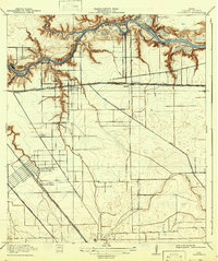
1919 Map of Deepwater
USGS Topo · Published 1942About this map
Buffalo Bayou dominates the northern landscape of this Harris County survey, showing the industrial and maritime foundations of the Houston Ship Channel during the early twentieth century. The map provides a remarkable view of early settlements like Pasadena, Clinton, and Deepwater before they were fully absorbed by metropolitan expansion. To the south, South Houston is identified alongside Dumont Sta, while specialized railroad features such as Fireworks Siding indicate the area's logistical importance.
Find a feature on this map
32 named features on this map. Tap any name to fly to it.
Don’t see what you’re looking for? This feature index may not catch every label — zoom into the map to look around manually.
Map Details
Editions of this 1919 Deepwater Map
2 editions found
Other maps of this area

1915 · Park Place
USGS Topo · 1:24,000

1915 · Deepwater
USGS Topo · 1:24,000

1916 · Genoa
USGS Topo · 1:24,000

1916 · Burnett Bay
USGS Topo · 1:24,000

1916 · Settegast
USGS Topo · 1:24,000

1916 · Seabrook
USGS Topo · 1:24,000

1916 · Fauna
USGS Topo · 1:24,000

1916 · La Porte
USGS Topo · 1:24,000

1919 · Deepwater
USGS Topo · 1:31,680

1920 · Seabrook
USGS Topo · 1:31,680