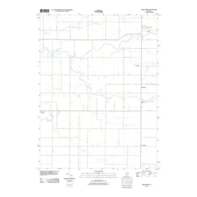
2010 Map of Deer Creek
USGS Topo · Published 2010About this map
Deer Creek flows through the heart of Carroll County, anchoring a landscape defined by an orderly grid of country roads and agricultural drainage systems. The settlement of Wheeling sits near the eastern edge, while Sharon and Carrollton occupy the southeastern quadrant, illustrating the dispersed residential pattern of this rural Indiana corridor. Significant local history is preserved at the Hopewell Cemetery, United Brethren Cemetery, and Maple Lawn Cemetery, which serve as permanent records of the early families who settled this region. The map meticulously documents the hydrography of the area, showing how natural waterways like Paint Creek and Little Deer Creek are supplemented by man-made channels such as McCloskey Ditch and Ridenour Ditch to manage the fertile tillable land. In the southern reaches, Bachelor Run meanders toward the county line, providing a rare deviation from the rectilinear survey lines of the section roads.
Find a feature on this map
55 named features on this map. Tap any name to fly to it.
Don’t see what you’re looking for? This feature index may not catch every label — zoom into the map to look around manually.
Map Details
Editions of this 2010 Deer Creek Map
This is the sole edition of this map. No revisions or reprints were ever made.
Other maps of this area

1953 · Danville
USGS Topo · 1:250,000

1955 · Danville
USGS Topo · 1:250,000

1955 · Anoka
USGS Topo · 1:24,000

1956 · Danville
USGS Topo · 1:250,000

1959 · Young America
USGS Topo · 1:24,000

1961 · Russiaville
USGS Topo · 1:24,000

1961 · Rossville
USGS Topo · 1:24,000

1961 · Burlington
USGS Topo · 1:24,000

1962 · Deer Creek
USGS Topo · 1:24,000

1962 · Flora
USGS Topo · 1:24,000