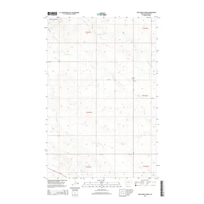
2014 Map of Deer Creek Church
USGS Topo · Published 2014About this map
The Big Sheep Mountains rise along the northwestern edge of this Dawson County landscape, framing a region defined by the branching drainages of the Middle Fork Deer Creek and S Fork Deer Creek. This 2014 survey documents a quiet rural corner of eastern Montana where agricultural and community landmarks persist amidst the vast sections of the Public Land Survey System. A primary point of local history is found at the intersection of MT-470 and Road 446, where the Deer Creek Church and its associated W Church Cem are situated. The map illustrates a network of county roads, including Road 452 and Road 450, that navigate the undulating terrain and seasonal waterways like Spring Creek. This modern record is an essential tool for those tracing genealogy in the Big Sheep Mountains vicinity or studying the persistent rural infrastructure of the Montana plains.
Find a feature on this map
21 named features on this map. Tap any name to fly to it.
Don’t see what you’re looking for? This feature index may not catch every label — zoom into the map to look around manually.
Map Details
Editions of this 2014 Deer Creek Church Map
This is the sole edition of this map. No revisions or reprints were ever made.
Other maps of this area

1954 · Glendive
USGS Topo · 1:250,000

1957 · Glendive
USGS Topo · 1:250,000

1958 · Glendive
USGS Topo · 1:250,000

1982 · Circle
USGS Topo · 1:100,000

1983 · Johnson Reservoir NW
USGS Topo · 1:24,000
1983 · Union School
USGS Topo · 1:24,000
1983 · Johnson Reservoir
USGS Topo · 1:24,000

1983 · Olson Coulee South
USGS Topo · 1:24,000
1983 · Woodrow
USGS Topo · 1:24,000

1983 · Deer Creek Church
USGS Topo · 1:24,000