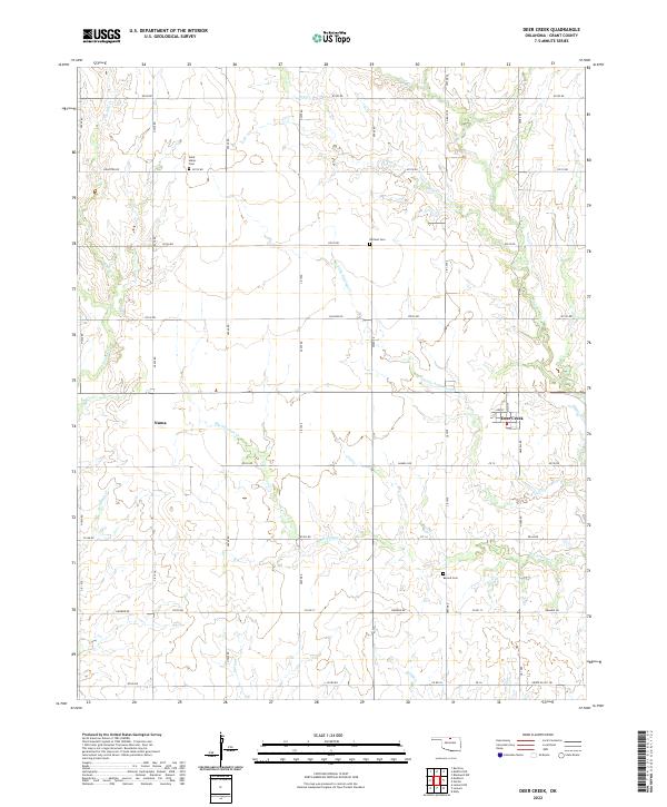
2022 Map of Deer Creek
USGS Topo · Published 2022About this map
Deer Creek serves as the primary hub of this agricultural landscape in Grant County, situated at the intersection of a sprawling rural road network. The town's grid is small but defined, while the surrounding territory is marked by the branching drainage systems of Big Antelope Cr and Little Antelope Cr. To the west, the smaller community of Numa sits along a north-south thoroughfare. This map provides critical details for family historians, documenting several rural burial sites that anchor the early pioneer history of the townships. These include Saint Marys Cem in the northwest, Darland Cem near the center, and Bayard Cem in the southeast. The terrain is further defined by various seasonal waterways, such as Elm Cr, Deadman Cr, and Polecat Cr, which carve subtle paths through the section lines of the Public Land Survey System.
Find a feature on this map
55 named features on this map. Tap any name to fly to it.
Don’t see what you’re looking for? This feature index may not catch every label — zoom into the map to look around manually.
Map Details
Editions of this 2022 Deer Creek Map
This is the sole edition of this map. No revisions or reprints were ever made.
Other maps of this area

1955 · Enid
USGS Topo · 1:250,000

1958 · Enid
USGS Topo · 1:250,000

1968 · Lamont NW
USGS Topo · 1:24,000

1968 · Deer Creek
USGS Topo · 1:24,000

1968 · Eddy
USGS Topo · 1:24,000

1968 · Blackwell NW
USGS Topo · 1:24,000

1968 · Nardin
USGS Topo · 1:24,000

1968 · Renfrow
USGS Topo · 1:24,000

1968 · Medford
USGS Topo · 1:24,000

1968 · Lamont
USGS Topo · 1:24,000