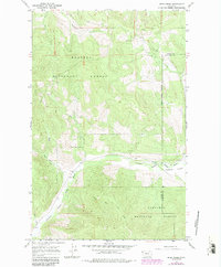
1966 Map of Deer Creek
USGS Topo · Published 1984About this map
Kootenai National Forest blankets the high country of the Montana Rockies in this 1960s study, updated with photorevisions in the early 1980s. The landscape is defined by the steep descent toward Pleasant Valley and the south-flowing Fisher River. The surveyor's notes and contour lines reveal a network of drainages including Deer Creek, Calx Creek, and Tamarack Creek that feed into the larger river system. Along the valley floor, the presence of a Gravel Pit and scattered Gravel Pits suggests localized resource extraction supporting the area's development. Crossing the high Meadow Ridge, a legacy (Pack) Trail and the clearly marked National Forest Boundary delineate the interface between public wilderness and the encroaching Lincoln and Flathead county lines.
Find a feature on this map
15 named features on this map. Tap any name to fly to it.
Don’t see what you’re looking for? This feature index may not catch every label — zoom into the map to look around manually.
Map Details
Editions of this 1966 Deer Creek Map
2 editions found
Other maps of this area

1920 · Jennings
USGS Topo · 1:125,000

1935 · Thompson Lakes
USGS Topo · 1:96,000

1942 · Thompson Lakes
USGS Topo · 1:125,000

1957 · Kalispell
USGS Topo · 1:250,000

1960 · Kalispell
USGS Topo · 1:250,000

1961 · Kalispell
USGS Topo · 1:250,000

1963 · Wolf Prairie
USGS Topo · 1:24,000
1963 · Horse Hill
USGS Topo · 1:24,000
1963 · Richards Mountain
USGS Topo · 1:24,000

1964 · Meadow Peak
USGS Topo · 1:24,000