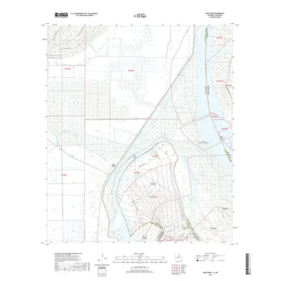
2018 Map of Deer Park
USGS Topo · Published 2018About this map
Deer Park and its surrounding wetlands occupy a complex landscape where the Mississippi River forms the border between Louisiana's Concordia Parish and Mississippi's Adams County. This environment is characterized by the dynamic movement of the river, which has left behind significant oxbow features such as Old River and Briars Chute. To the west, the topography transitions into a dense network of waterways including Bayou Cocodrie and Mississippi Bayou, punctuated by the recreational corridors of the Wallace Lake Red Trail and Wallace Lake White Trail near Wallace Lake. The land within the river's great bends, such as Deer Park Bend and Saint Catherine Bend, is divided by a geometric grid of local roads including Frog Pond Rd and Main Rd, illustrating the intersection of natural riverine cycles with organized human settlement and land management along the parish line.
Find a feature on this map
38 named features on this map. Tap any name to fly to it.
Don’t see what you’re looking for? This feature index may not catch every label — zoom into the map to look around manually.
Map Details
Editions of this 2018 Deer Park Map
This is the sole edition of this map. No revisions or reprints were ever made.
Other maps of this area

1909 · Sycamore Landing
USGS Topo · 1:24,000

1909 · Vidalia
USGS Topo · 1:24,000

1921 · Natchez
USGS Topo · 1:48,000

1922 · Natchez
USGS Topo · 1:62,500

1939 · Red Gum
USGS Topo · 1:62,500

1939 · Natchez
USGS Topo · 1:62,500

1939 · Kingston
USGS Topo · 1:62,500

1939 · Deer Park
USGS Topo · 1:62,500

1953 · Natchez
USGS Topo · 1:250,000

1956 · Natchez
USGS Topo · 1:250,000