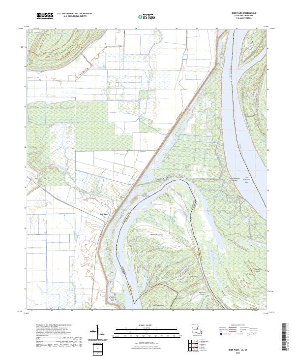
2024 Map of Deer Park
USGS Topo · Published 2024About this map
Mississippi River dynamics dominate this Concordia Parish landscape, where the shifting channel defines the border between Louisiana and Mississippi. The area around Deer Park and the bend to its south reveals a complex network of active and former river paths, including Old River and Briars Chute. Large-scale conservation efforts are evident in the Bayou Cocodrie National Wildlife Refuge and Saint Catherine Creek National Wildlife Refuge, protecting the bottomland hardwood habitats and wetlands typical of the Lower Mississippi Valley.
Find a feature on this map
39 named features on this map. Tap any name to fly to it.
Don’t see what you’re looking for? This feature index may not catch every label — zoom into the map to look around manually.
Map Details
Editions of this 2024 Deer Park Map
This is the sole edition of this map. No revisions or reprints were ever made.
Other maps of this area

1909 · Sycamore Landing
USGS Topo · 1:24,000

1909 · Vidalia
USGS Topo · 1:24,000

1921 · Natchez
USGS Topo · 1:48,000

1922 · Natchez
USGS Topo · 1:62,500

1939 · Red Gum
USGS Topo · 1:62,500

1939 · Natchez
USGS Topo · 1:62,500

1939 · Kingston
USGS Topo · 1:62,500

1939 · Deer Park
USGS Topo · 1:62,500

1953 · Natchez
USGS Topo · 1:250,000

1956 · Natchez
USGS Topo · 1:250,000