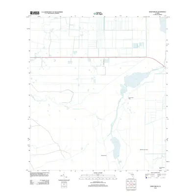
2012 Map of Deer Park SE
USGS Topo · Published 2012About this map
The Saint Johns River serpentines through this landscape south of Palm Bay, defining a vast marshland and riverine system in 2012. The topography is dominated by interconnected water bodies, including Lake Hellen Blazes, Sawgrass Lake, and Little Sawgrass Lake. Historically significant markers of previous land use are found in the form of named fields, specifically North Indian Field, Middle Indian Field, and South Indian Field, which align with the eastern edge of the river valley.
Find a feature on this map
15 named features on this map. Tap any name to fly to it.
Don’t see what you’re looking for? This feature index may not catch every label — zoom into the map to look around manually.
Map Details
Editions of this 2012 Deer Park SE Map
This is the sole edition of this map. No revisions or reprints were ever made.
Other maps of this area

1949 · Melbourne West
USGS Topo · 1:24,000

1949 · Eau Gallie
USGS Topo · 1:24,000

1951 · Eau Gallie
USGS Topo · 1:24,000

1951 · Melbourne West
USGS Topo · 1:24,000

1953 · Deer Park NE
USGS Topo · 1:24,000

1953 · Fellsmere NW
USGS Topo · 1:24,000

1953 · Deer Park SE
USGS Topo · 1:24,000

1953 · Kenansville
USGS Topo · 1:24,000

1953 · Deer Park NW
USGS Topo · 1:24,000

1953 · Kenansville NE
USGS Topo · 1:24,000