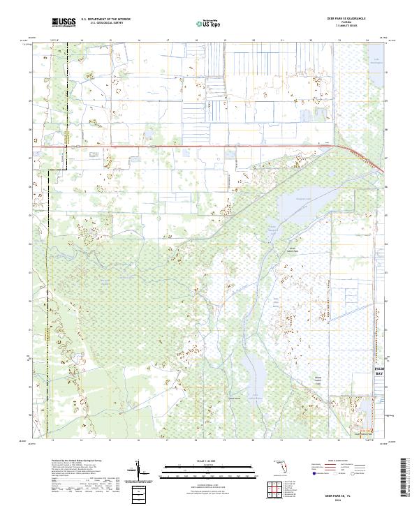
2024 Map of Deer Park SE
USGS Topo · Published 2024About this map
The Saint Johns River corridor dominates this landscape along the Osceola and Brevard County line, creating a complex freshwater network of lakes and marshland. The waterway connects Sawgrass Lake and Little Sawgrass Lake to the north, while Lake Hellen Blazes sits at the southern edge of the sheet. Between these bodies of water lies the expansive Saint Johns Marsh, a region defined by its hydrography rather than human settlement.
Find a feature on this map
29 named features on this map. Tap any name to fly to it.
Don’t see what you’re looking for? This feature index may not catch every label — zoom into the map to look around manually.
Map Details
Editions of this 2024 Deer Park SE Map
This is the sole edition of this map. No revisions or reprints were ever made.
Other maps of this area

1949 · Melbourne West
USGS Topo · 1:24,000

1949 · Eau Gallie
USGS Topo · 1:24,000

1951 · Eau Gallie
USGS Topo · 1:24,000

1951 · Melbourne West
USGS Topo · 1:24,000

1953 · Deer Park NE
USGS Topo · 1:24,000

1953 · Fellsmere NW
USGS Topo · 1:24,000

1953 · Deer Park SE
USGS Topo · 1:24,000

1953 · Kenansville
USGS Topo · 1:24,000

1953 · Deer Park NW
USGS Topo · 1:24,000

1953 · Kenansville NE
USGS Topo · 1:24,000