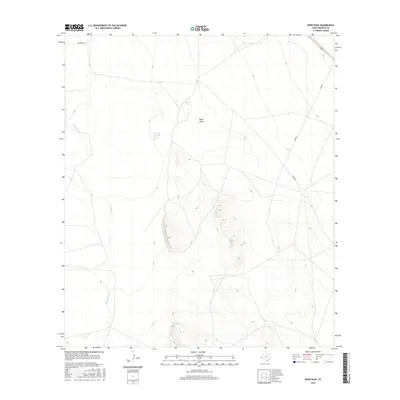
2016 Map of Deer Peak
USGS Topo · Published 2016About this map
Nine Mile Waterhole Spring serves as a vital water source in this high-desert region of Presidio County, marking a specific point of human and animal interest within the arid landscape. The terrain is defined by the drainage patterns of Wild Horse Cr and the broad Ryan Draw, which channel seasonal moisture across the high plains. Transport across this sparsely settled territory relies on a network of unpaved corridors, including Old Brite Rd and Ryan Rd, which link the isolated ranching properties of the Big Bend country. The map illustrates a ranching economy where access to water and the navigation of subtle topographic shifts dictate the placement of roads and landmarks in a vast, open environment.
Find a feature on this map
6 named features on this map. Tap any name to fly to it.
Don’t see what you’re looking for? This feature index may not catch every label — zoom into the map to look around manually.
Map Details
Editions of this 2016 Deer Peak Map
This is the sole edition of this map. No revisions or reprints were ever made.
Other maps of this area

1892 · Chispa
USGS Topo · 1:125,000

1894 · Valentine
USGS Topo · 1:125,000

1895 · Chispa
USGS Topo · 1:125,000

1895 · Marfa
USGS Topo · 1:125,000

1896 · San Carlos
USGS Topo · 1:125,000

1897 · Valentine
USGS Topo · 1:125,000

1897 · Chispa
USGS Topo · 1:125,000

1943 · Valentine
USGS Topo · 1:125,000

1959 · Marfa
USGS Topo · 1:250,000

1965 · Marfa
USGS Topo · 1:250,000