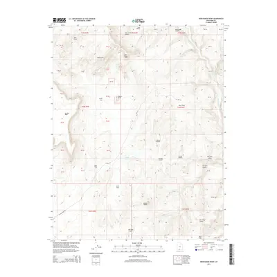
2014 Map of Deer Range Point
USGS Topo · Published 2014About this map
The White Cliffs and high plateaus of southern Utah dominate this landscape, where deep drainages like Kitchen Canyon and Box Elder Canyon cut through the high desert. This 2014 survey captures a terrain defined by its dramatic verticality, from the towering No Mans Mesa to the prominent landmark of Mollies Nipple. The Paria River and its tributary Snake Cr provide the primary watercourses, while Nipple Lake sits as a rare interior basin feature. Access through this remote corner of Kane County is limited to primitive routes such as Oil Well Rd and Buckskin Wash Rd, reflecting the area's isolation and lack of permanent settlement. Researchers can trace the complex network of swags—including North Swag and South Swag—that separate the distinct benches and points like Deer Range Point and Kirbys Point.
Find a feature on this map
31 named features on this map. Tap any name to fly to it.
Don’t see what you’re looking for? This feature index may not catch every label — zoom into the map to look around manually.
Map Details
Editions of this 2014 Deer Range Point Map
This is the sole edition of this map. No revisions or reprints were ever made.
Other maps of this area

1886 · Kanab
USGS Topo · 1:250,000

1886 · Escalante
USGS Topo · 1:250,000

1953 · Cedar City
USGS Topo · 1:250,000

1954 · Buckskin Gulch NW
USGS Topo · 1:24,000

1954 · Buckskin Gulch NE
USGS Topo · 1:24,000

1954 · Paria NW
USGS Topo · 1:24,000

1954 · Buckskin Gulch
USGS Topo · 1:62,500

1954 · Paria
USGS Topo · 1:62,500

1955 · The Cockscob SW
USGS Topo · 1:24,000

1956 · Escalante
USGS Topo · 1:250,000