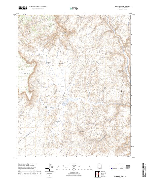
2023 Map of Deer Range Point
USGS Topo · Published 2023About this map
Grand Staircase-Escalante National Monument encompasses the vast majority of this landscape, defining a region where high plateaus and deep drainage systems meet. The terrain is marked by dramatic elevation shifts from the White Cliffs and Deer Range Point down into the winding course of the Paria River. Named landmarks like Mollies Nipple and Potters Butte provide clear navigational anchors across the high ground of the Deer Range and No Mans Mesa.
Find a feature on this map
26 named features on this map. Tap any name to fly to it.
Don’t see what you’re looking for? This feature index may not catch every label — zoom into the map to look around manually.
Map Details
Editions of this 2023 Deer Range Point Map
This is the sole edition of this map. No revisions or reprints were ever made.
Other maps of this area

1886 · Kanab
USGS Topo · 1:250,000

1886 · Escalante
USGS Topo · 1:250,000

1953 · Cedar City
USGS Topo · 1:250,000

1954 · Buckskin Gulch NW
USGS Topo · 1:24,000

1954 · Buckskin Gulch NE
USGS Topo · 1:24,000

1954 · Paria NW
USGS Topo · 1:24,000

1954 · Buckskin Gulch
USGS Topo · 1:62,500

1954 · Paria
USGS Topo · 1:62,500

1955 · The Cockscob SW
USGS Topo · 1:24,000

1956 · Escalante
USGS Topo · 1:250,000