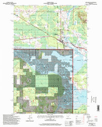
1996 Map of Deer River
USGS Topo · Published 1998About this map
White Oak Lake and the winding Mississippi River dominate this mid-1990s survey of Itasca County, where the water system defines the local geography. The settlement of Deer River serves as a central hub, flanked by the smaller community of Zemple and the expansive wetlands of the Chippewa National Forest. The map captures a landscape shaped by both nature and utility, showing extensive rice paddies and a gas pipeline cutting across the terrain north of the river.
Find a feature on this map
30 named features on this map. Tap any name to fly to it.
Don’t see what you’re looking for? This feature index may not catch every label — zoom into the map to look around manually.
Map Details
Editions of this 1996 Deer River Map
This is the sole edition of this map. No revisions or reprints were ever made.
Other maps of this area

1953 · Siseebakwet Lake
USGS Topo · 1:24,000

1953 · Cohasset West
USGS Topo · 1:24,000

1954 · Hibbing
USGS Topo · 1:250,000

1957 · Hibbing
USGS Topo · 1:250,000

1958 · Hibbing
USGS Topo · 1:250,000

1964 · Hibbing
USGS Topo · 1:250,000

1970 · Deer River NE
USGS Topo · 1:24,000
1970 · Deer River
USGS Topo · 1:24,000

1970 · Ball Club
USGS Topo · 1:24,000
1970 · Little Bowstring Lake
USGS Topo · 1:24,000
Featured Places
- Deer River, MN
- Zemple, MN
- Days High Landing, MN
- Liston Evergreen Mobile Home Park, Deer River
- Itasca County, MN