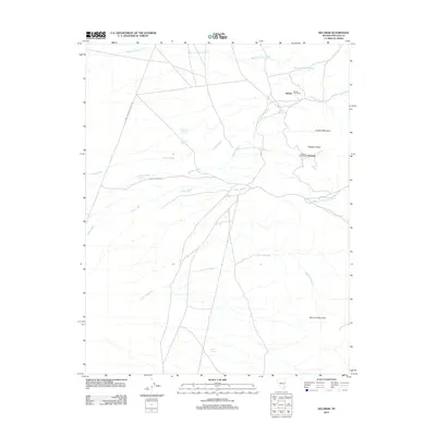
2012 Map of Delamar
USGS Topo · Published 2012About this map
Delamar and the nearby settlement of Helene anchor this high-desert landscape in Lincoln County, Nevada. The presence of two historic post offices, the Delamar Post Office and Helene Post Office, points to the area's significance as a hub for local mining and ranching interests in a region defined by seasonal watercourses. The geography is dominated by a complex network of dry washes, including Delamar Wash, Monkey Wrench Wash, and the several branches of Cedar Wash, which drain the surrounding highlands toward the valley floor. Rare reliable water sources like Blythe Spring and Bruno Spring represent critical landmarks for early inhabitants. To the east, the terrain rises sharply toward Lookout Mountain and Big Lime Mountain, separated by the distinctive Hogpen Shoot, while the infrastructure of the Power Line Maintenance Rd provides a modern contrast to older trails leading to Old Indian Spring.
Find a feature on this map
20 named features on this map. Tap any name to fly to it.
Don’t see what you’re looking for? This feature index may not catch every label — zoom into the map to look around manually.
Map Details
Editions of this 2012 Delamar Map
This is the sole edition of this map. No revisions or reprints were ever made.
Other maps of this area

1885 · Pioche
USGS Topo · 1:250,000

1886 · Pioche
USGS Topo · 1:250,000

1954 · Caliente
USGS Topo · 1:250,000

1959 · Caliente
USGS Topo · 1:250,000

1969 · Delamar
USGS Topo · 1:24,000

1969 · Gregerson Basin
USGS Topo · 1:24,000

1969 · Slidy Mountain
USGS Topo · 1:24,000

1969 · Delamar NW
USGS Topo · 1:24,000
1969 · Delamar Lake
USGS Topo · 1:24,000

1969 · Elgin SW
USGS Topo · 1:24,000