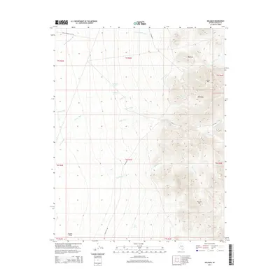
2014 Map of Delamar
USGS Topo · Published 2014About this map
Delamar and Helene anchor this high-desert landscape in Lincoln County, where the topography is defined by significant elevation changes between the peaks and the broad expanse of Delamar Valley. The presence of Blythe Spring, New Indian Spring, and Old Indian Spring suggests the historical importance of water sources in this arid region, providing critical stopovers for travelers and miners moving through the mountains. Transport routes such as Cedar Wash Rd and Delmar Rd navigate the complex drainage systems including Monkey Wrench Wash and Big Lime Wash. Prominent peaks like Lookout Mtn and Big Lime Mtn overlook the canyon networks and old road systems, offering a clear view of the area's geological character and the footprints of early Nevada settlement.
Find a feature on this map
28 named features on this map. Tap any name to fly to it.
Don’t see what you’re looking for? This feature index may not catch every label — zoom into the map to look around manually.
Map Details
Editions of this 2014 Delamar Map
This is the sole edition of this map. No revisions or reprints were ever made.
Other maps of this area

1885 · Pioche
USGS Topo · 1:250,000

1886 · Pioche
USGS Topo · 1:250,000

1954 · Caliente
USGS Topo · 1:250,000

1959 · Caliente
USGS Topo · 1:250,000

1969 · Delamar
USGS Topo · 1:24,000

1969 · Gregerson Basin
USGS Topo · 1:24,000

1969 · Slidy Mountain
USGS Topo · 1:24,000

1969 · Delamar NW
USGS Topo · 1:24,000
1969 · Delamar Lake
USGS Topo · 1:24,000

1969 · Elgin SW
USGS Topo · 1:24,000