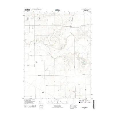
2015 Map of Delavan North
USGS Topo · Published 2015About this map
The Mackinaw River meanders across this Tazewell County landscape, carving a distinct valley that separates the rural settlements of Dillon and Delavan. This mid-2010s survey illustrates a region defined by agricultural continuity and scattered residential pockets, such as those near Venado Grande Lake. The map serves as a detailed record for genealogists, pinpointing several local burial sites including Saint Mary's Catholic Cem, Antioch Cem, and Woodrow Cem. Transport infrastructure ranges from the small Lutz RLA Airport to an extensive grid of country roads, including Red Shale Hill Rd and Mennonite Church Rd. The drainage patterns of Dillon Cr and Dry Cr define the local topography, highlighting the relationship between the prairie hydrology and the longstanding farmstead sites of the central Illinois plains.
Find a feature on this map
56 named features on this map. Tap any name to fly to it.
Don’t see what you’re looking for? This feature index may not catch every label — zoom into the map to look around manually.
Map Details
Editions of this 2015 Delavan North Map
This is the sole edition of this map. No revisions or reprints were ever made.
Other maps of this area

1905 · Peoria
USGS Topo · 1:62,500

1927 · Peoria
USGS Topo · 1:62,500

1928 · Mackinaw
USGS Topo · 1:62,500

1932 · Mackinaw
USGS Topo · 1:62,500

1942 · Delavan
USGS Topo · 1:62,500

1951 · Minier
USGS Topo · 1:62,500

1958 · Peoria
USGS Topo · 1:250,000

1960 · Marquette Heights
USGS Topo · 1:24,000

1960 · Pekin
USGS Topo · 1:24,000

1961 · Peoria
USGS Topo · 1:250,000