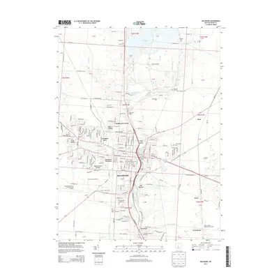
2013 Map of Delaware
USGS Topo · Published 2013About this map
The Olentangy River serves as the central spine for this 2013 survey, bisecting the city of Delaware and its surrounding residential neighborhoods. This area shows significant educational and athletic infrastructure, prominently featuring the Ohio Wesleyan University campus with landmarks such as Selby Stadium, Edwards Gym, and the Branch Rickey Arena. The southward expansion of the city is evident in the transition from the historic core toward settlements like Stratford and the campus of the Methodist Theological School in Ohio.
Find a feature on this map
118 named features on this map. Tap any name to fly to it.
Don’t see what you’re looking for? This feature index may not catch every label — zoom into the map to look around manually.
Map Details
Editions of this 2013 Delaware Map
This is the sole edition of this map. No revisions or reprints were ever made.
Other maps of this area

1901 · Dublin
USGS Topo · 1:62,500

1902 · Westerville
USGS Topo · 1:62,500

1903 · Dublin
USGS Topo · 1:62,500

1904 · Westerville
USGS Topo · 1:62,500

1915 · Marengo
USGS Topo · 1:62,500

1924 · Delaware
USGS Topo · 1:62,500

1925 · Delaware
USGS Topo · 1:62,500

1943 · Marengo
USGS Topo · 1:62,500

1944 · Delaware
USGS Topo · 1:62,500

1950 · Marion
USGS Topo · 1:250,000