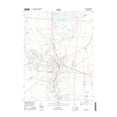
2016 Map of Delaware
USGS Topo · Published 2016About this map
The Olentangy River serves as the central axis for this landscape, carving through the terrain to create the distinctive Horse Shoe Bottom before flowing south past the city of Delaware. Higher education and regional institutions anchor the community, notably the sprawling campus of Ohio Wesleyan University and the Methodist Theological School in Ohio located near Stratford. This 2016 survey captures the suburban expansion around the city, while still preserving traces of the area's agricultural and industrial roots. The Stone Mill Bridge and several burial grounds, such as Oak Grove Cemetery and Pleasant Hill Cemetery, provide valuable landmarks for local historians. Transportation networks include major thoroughfares like Us Rte 23 and aviation sites ranging from the Delaware Municipal Airport - Jim Moore Field to the smaller Obi One Airport and the Berlin Station Landing Strip near West Berlin.
Find a feature on this map
147 named features on this map. Tap any name to fly to it.
Don’t see what you’re looking for? This feature index may not catch every label — zoom into the map to look around manually.
Map Details
Editions of this 2016 Delaware Map
This is the sole edition of this map. No revisions or reprints were ever made.
Other maps of this area

1901 · Dublin
USGS Topo · 1:62,500

1902 · Westerville
USGS Topo · 1:62,500

1903 · Dublin
USGS Topo · 1:62,500

1904 · Westerville
USGS Topo · 1:62,500

1915 · Marengo
USGS Topo · 1:62,500

1924 · Delaware
USGS Topo · 1:62,500

1925 · Delaware
USGS Topo · 1:62,500

1943 · Marengo
USGS Topo · 1:62,500

1944 · Delaware
USGS Topo · 1:62,500

1950 · Marion
USGS Topo · 1:250,000