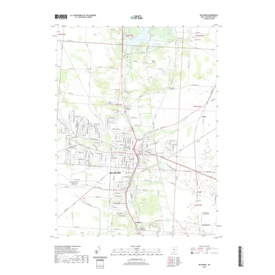
2019 Map of Delaware
USGS Topo · Published 2019About this map
Ohio Wesleyan University stands at the heart of this central Ohio landscape, situated just west of the Olentangy River. The city of Delaware serves as a dense hub of civic and academic life, anchored by the Delaware County Courthouse and sprawling residential developments that stretch toward Delaware Lake in the north. To the south, the village of Stratford and the Methodist Theological School in Ohio sit along the riverbanks, marking a transition into more open country. The terrain is defined by a series of waterways, including Horseshoe Run and Sugar Run, which cut through the landscape toward the river. Notable landmarks like the Stone Mill Bridge and several burial grounds, such as Oak Grove Cem and the Troy Chapel-Cem, provide significant points of interest for those tracing the development and genealogy of the county seat.
Find a feature on this map
55 named features on this map. Tap any name to fly to it.
Don’t see what you’re looking for? This feature index may not catch every label — zoom into the map to look around manually.
Map Details
Editions of this 2019 Delaware Map
This is the sole edition of this map. No revisions or reprints were ever made.
Other maps of this area

1901 · Dublin
USGS Topo · 1:62,500

1902 · Westerville
USGS Topo · 1:62,500

1903 · Dublin
USGS Topo · 1:62,500

1904 · Westerville
USGS Topo · 1:62,500

1915 · Marengo
USGS Topo · 1:62,500

1924 · Delaware
USGS Topo · 1:62,500

1925 · Delaware
USGS Topo · 1:62,500

1943 · Marengo
USGS Topo · 1:62,500

1944 · Delaware
USGS Topo · 1:62,500

1950 · Marion
USGS Topo · 1:250,000