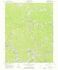
1963 Map of Delbarton
USGS Topo · Published 1976About this map
Pigeon Creek and the Tug Fork define the movement and settlement patterns of this central Appalachian coal region. Along these winding valleys, narrow-gauge rail infrastructure of the Norfolk and Western connects mining outposts and company towns such as Cinderella, Lando Mines, and Red Jacket. The map reveals a landscape heavily shaped by industrial activity, with numerous Gas Wells, Tipples, and Strip Mines appearing alongside the steep ridges of Buffalo Mtn.
Find a feature on this map
72 named features on this map. Tap any name to fly to it.
Don’t see what you’re looking for? This feature index may not catch every label — zoom into the map to look around manually.
Map Details
Editions of this 1963 Delbarton Map
3 editions found
Other maps of this area

1887 · Warfield
USGS Topo · 1:125,000

1891 · Warfield
USGS Topo · 1:125,000

1909 · Matewan
USGS Topo · 1:48,000

1910 · Holden
USGS Topo · 1:48,000

1910 · Naugatuck
USGS Topo · 1:48,000

1912 · Naugatuck
USGS Topo · 1:62,500

1912 · Holden
USGS Topo · 1:62,500

1915 · Williamson
USGS Topo · 1:48,000

1915 · Naugatuck
USGS Topo · 1:48,000

1915 · Matewan
USGS Topo · 1:48,000