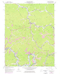
1963 Map of Delbarton
USGS Topo · Published 1978About this map
Pigeon Creek and the Tug River define the industrial and residential corridors of Mingo County during this mid-century period. The map details the intensive coal mining infrastructure typical of the era, with prominent features like the Lando Mines, a Tipple near Lobata, and numerous Mine sites and conveyors etched into the steep hillsides. The Norfolk and Western railway follows the river bends, connecting significant coal towns like Red Jacket, Matewan, and Delbarton.
Find a feature on this map
78 named features on this map. Tap any name to fly to it.
Don’t see what you’re looking for? This feature index may not catch every label — zoom into the map to look around manually.
Map Details
Editions of this 1963 Delbarton Map
3 editions found
Other maps of this area

1887 · Warfield
USGS Topo · 1:125,000

1891 · Warfield
USGS Topo · 1:125,000

1909 · Matewan
USGS Topo · 1:48,000

1910 · Holden
USGS Topo · 1:48,000

1910 · Naugatuck
USGS Topo · 1:48,000

1912 · Naugatuck
USGS Topo · 1:62,500

1912 · Holden
USGS Topo · 1:62,500

1915 · Williamson
USGS Topo · 1:48,000

1915 · Naugatuck
USGS Topo · 1:48,000

1915 · Matewan
USGS Topo · 1:48,000