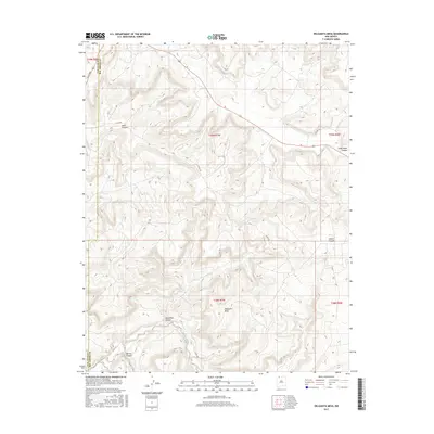
2017 Map of Delgadita Mesa
USGS Topo · Published 2017About this map
Delgadita Mesa dominates the central landscape of this New Mexico quadrangle, where the border of San Juan and Rio Arriba counties cuts through a series of significant drainage systems. The terrain is defined by deep incisions such as Gobernador Canyon and Jasis Canyon to the north, and Delgadita Canyon further south. These canyons channel seasonal runoff into Carrizo Creek, which winds through the southwest corner of the sheet near Martin Canyon. The transportation network is sparse, reflecting the area's transition into more remote high-desert plateau country. While modern county routes serve the region, the presence of Old Hwy 64 in the northeast provides a trace of older thoroughfares that once linked these isolated mesa lands. The map illustrates a landscape primarily shaped by natural erosion and limited rural access roads.
Find a feature on this map
17 named features on this map. Tap any name to fly to it.
Don’t see what you’re looking for? This feature index may not catch every label — zoom into the map to look around manually.
Map Details
Editions of this 2017 Delgadita Mesa Map
This is the sole edition of this map. No revisions or reprints were ever made.
Other maps of this area

1889 · Largo
USGS Topo · 1:250,000

1895 · Largo
USGS Topo · 1:250,000

1954 · Pine River
USGS Topo · 1:24,000

1954 · Gomez Ranch
USGS Topo · 1:24,000

1954 · Aztec
USGS Topo · 1:250,000

1958 · Aztec
USGS Topo · 1:250,000

1959 · Gould Pass
USGS Topo · 1:62,500

1959 · Navajo Dam
USGS Topo · 1:62,500

1962 · Aztec
USGS Topo · 1:250,000

1963 · Fourmile Canyon
USGS Topo · 1:24,000