
1963 Map of Fourmile Canyon
USGS Topo · Published 1965About this map
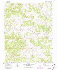
Frances Mesa and the surrounding high desert plateaus of Rio Arriba County dominate this early 1960s survey. The landscape is defined by the sharp incisions of Gobernador Canyon and Fourmile Canyon, revealing a terrain utilized for both cattle grazing and resource extraction. Evidence of the region's mid-century energy development is visible through a network of pipelines and numerous gas wells scattered across Navajo Pasture. The map provides a look at the remote Gobernador Camp and the nearby Gobernador Sch, indicating a small, localized community center supporting the area's ranchers and oil field workers. This era represents a period when mechanical improvements, like the local Landing Strip, were becoming essential for navigating and managing the vast distances between isolated settlements and industrial outposts in the San Juan Basin.
Find a feature on this map
14 named features on this map. Tap any name to fly to it.
Don’t see what you’re looking for? This feature index may not catch every label — zoom into the map to look around manually.
Map Details
Editions of this 1963 Fourmile Canyon Map
2 editions found
Other maps of this area

1889 · Largo
USGS Topo · 1:250,000

1895 · Largo
USGS Topo · 1:250,000

1954 · Pine River
USGS Topo · 1:24,000

1954 · Gomez Ranch
USGS Topo · 1:24,000

1954 · Aztec
USGS Topo · 1:250,000

1958 · Aztec
USGS Topo · 1:250,000

1959 · Gould Pass
USGS Topo · 1:62,500

1959 · Navajo Dam
USGS Topo · 1:62,500

1962 · Aztec
USGS Topo · 1:250,000
1963 · Espinosa Ranch
USGS Topo · 1:24,000