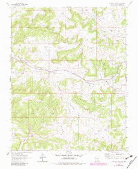
1963 Map of Fourmile Canyon
USGS Topo · Published 1983About this map
The San Juan Gas Field defines the industrial character of this high desert landscape, where a dense network of pipelines and Gas Wells punctuates the terrain between deep drainage systems. Central to the area is Gobernador Canyon, which serves as a natural corridor for movement through the mesas. The small settlement at Gobernador Camp includes the Gobernador Sch, marking a rare point of permanent habitation in a region primarily dedicated to energy extraction. High elevations like Frances Mesa and Devils Spring Mesa overlook complex canyon systems including Fourmile Canyon and Encierro Canyon. The mapping, updated with 1980s revisions, shows a landscape transitioning from traditional grazing in Navajo Pasture to a high-density utility infrastructure, supported by a remote Landing Strip for regional access.
Find a feature on this map
13 named features on this map. Tap any name to fly to it.
Don’t see what you’re looking for? This feature index may not catch every label — zoom into the map to look around manually.
Map Details
Editions of this 1963 Fourmile Canyon Map
2 editions found
Other maps of this area

1889 · Largo
USGS Topo · 1:250,000

1895 · Largo
USGS Topo · 1:250,000

1954 · Pine River
USGS Topo · 1:24,000

1954 · Gomez Ranch
USGS Topo · 1:24,000

1954 · Aztec
USGS Topo · 1:250,000

1958 · Aztec
USGS Topo · 1:250,000

1959 · Gould Pass
USGS Topo · 1:62,500

1959 · Navajo Dam
USGS Topo · 1:62,500

1962 · Aztec
USGS Topo · 1:250,000

1963 · Fourmile Canyon
USGS Topo · 1:24,000