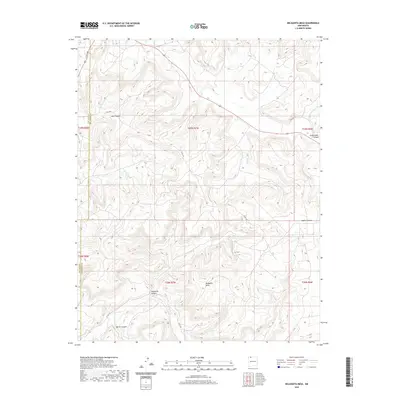
2020 Map of Delgadita Mesa
USGS Topo · Published 2020About this map
Delgadita Mesa dominates the landscape of this high-altitude terrain along the border of San Juan and Rio Arriba counties. The area is defined by a complex network of deep drainages, including Gobernador Canyon in the northeast and Jasis Canyon further west. This 2020 survey illustrates the modern road network servicing the region's energy resources and ranchlands, featuring routes like Co Rd 520 and Co Rd 492. Historical transportation traces are evident along Old Hwy 64, while the seasonal hydrology of Carrizo Cr and several named canyons like Delgadita Canyon shape the rugged topography. The map provides a precise view of the Public Land Survey System grid across parts of Townships 28 and 29 North, reflecting the organized division of this expansive New Mexico territory.
Find a feature on this map
18 named features on this map. Tap any name to fly to it.
Don’t see what you’re looking for? This feature index may not catch every label — zoom into the map to look around manually.
Map Details
Editions of this 2020 Delgadita Mesa Map
This is the sole edition of this map. No revisions or reprints were ever made.
Other maps of this area

1889 · Largo
USGS Topo · 1:250,000

1895 · Largo
USGS Topo · 1:250,000

1954 · Pine River
USGS Topo · 1:24,000

1954 · Gomez Ranch
USGS Topo · 1:24,000

1954 · Aztec
USGS Topo · 1:250,000

1958 · Aztec
USGS Topo · 1:250,000

1959 · Gould Pass
USGS Topo · 1:62,500

1959 · Navajo Dam
USGS Topo · 1:62,500

1962 · Aztec
USGS Topo · 1:250,000

1963 · Fourmile Canyon
USGS Topo · 1:24,000