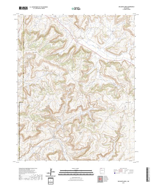
2023 Map of Delgadita Mesa
USGS Topo · Published 2023About this map
Delgadita Mesa defines the high ground of this landscape, situated along the county boundary where San Juan Co and Rio Arriba Co meet. The terrain is characterized by a series of deep drainages, most notably Gobernador Canyon in the northeast and Delgadita Canyon to the south. These natural corridors have long influenced movement through the high desert, reflected here in the path of Old Hwy 64 and various county routes like Co Rd 4800.
Find a feature on this map
12 named features on this map. Tap any name to fly to it.
Don’t see what you’re looking for? This feature index may not catch every label — zoom into the map to look around manually.
Map Details
Editions of this 2023 Delgadita Mesa Map
This is the sole edition of this map. No revisions or reprints were ever made.
Other maps of this area

1889 · Largo
USGS Topo · 1:250,000

1895 · Largo
USGS Topo · 1:250,000

1954 · Pine River
USGS Topo · 1:24,000

1954 · Gomez Ranch
USGS Topo · 1:24,000

1954 · Aztec
USGS Topo · 1:250,000

1958 · Aztec
USGS Topo · 1:250,000

1959 · Gould Pass
USGS Topo · 1:62,500

1959 · Navajo Dam
USGS Topo · 1:62,500

1962 · Aztec
USGS Topo · 1:250,000

1963 · Fourmile Canyon
USGS Topo · 1:24,000