
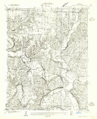
1935 Map of Dell
USGS Topo · Published 1935About this map
Lake of the Ozarks and the winding Missouri river dominate the northwestern corner of this 1935 survey, a moment when the shoreline and surrounding hills were dotted with recreational camps such as Hackberry Camp, Camp Court, and Shady Bayou Camp. The interior terrain of Benton County is deeply dissected by drainages like Big Turkey Creek and Whig Creek, which shaped the distribution of small farming communities and educational outposts.
Find a feature on this map
41 named features on this map. Tap any name to fly to it.
Don’t see what you’re looking for? This feature index may not catch every label — zoom into the map to look around manually.
Map Details
Editions of this 1935 Dell Map
This is the sole edition of this map. No revisions or reprints were ever made.
Other maps of this area

1887 · Warsaw
USGS Topo · 1:125,000

1894 · Warsaw
USGS Topo · 1:125,000

1935 · Edwards
USGS Topo · 1:24,000

1936 · Shawnee Bend
USGS Topo · 1:24,000

1936 · Lakeview Heights
USGS Topo · 1:24,000

1936 · Schuyler
USGS Topo · 1:24,000

1945 · Fristoe
USGS Topo · 1:62,500

1947 · Jefferson City
USGS Topo · 1:250,000

1954 · Jefferson City
USGS Topo · 1:250,000
1955 · Shawnee Bend
USGS Topo · 1:24,000