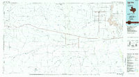
1985 Map of Dell City
USGS Topo · Published 1985About this map
Dell City and the surrounding high desert of Far West Texas are defined by a complex network of ephemeral drainage draws and massive mountain ranges in this mid-1980s study. The landscape transitions from the peaks of the Cornudas Mountains and the Sierra Tinaja Pinta into the wide expanse of the Salt Basin. This low-lying area features Linda Lake, Salt Lake, and the Alkalai Lakes, marking a region where water management is critical, as evidenced by the numerous tanks such as Crowley Tank and Bead Tank scattered across the arid terrain.
Find a feature on this map
71 named features on this map. Tap any name to fly to it.
Don’t see what you’re looking for? This feature index may not catch every label — zoom into the map to look around manually.
Map Details
Editions of this 1985 Dell City Map
2 editions found
Other maps of this area

1894 · Fort Hancock
USGS Topo · 1:125,000

1895 · Sierra Blanca
USGS Topo · 1:125,000

1896 · El Paso
USGS Topo · 1:125,000

1896 · Rio Grande
USGS Topo · 1:125,000

1903 · Cerro Alto
USGS Topo · 1:125,000

1906 · Van Horn
USGS Topo · 1:125,000

1908 · El Paso
USGS Topo · 1:125,000

1933 · Guadalupe Peak
USGS Topo · 1:48,000

1935 · El Paso Gap
USGS Topo · 1:62,500

1936 · El Paso Gap
USGS Topo · 1:48,000