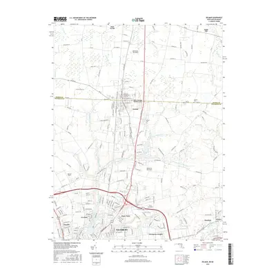
2016 Map of Delmar
USGS Topo · Published 2016About this map
The Delmar border community straddles the line between Delaware and Maryland, serving as a central hub for the northern reaches of the Delmarva Peninsula. This 2016 survey details the transition from the concentrated residential streets of Salisbury in the south, including the Westlake and Manokin neighborhoods, to the agricultural lands of Saint George and Smith Hill further north. The landscape is defined by the headwaters of the North Prong Wicomico River and its numerous tributaries like Connelly Mill Br and Leonard Pond Run. Genealogists will find significant value in the documentation of local burial sites, including Saint Stephens Cem and Oliphant Cem near the state line. Aviation history is also represented through the presence of both Ennis Aerodrome and Bennett Airport, marking the area's ongoing importance to regional transport and commerce.
Find a feature on this map
217 named features on this map. Tap any name to fly to it.
Don’t see what you’re looking for? This feature index may not catch every label — zoom into the map to look around manually.
Map Details
Editions of this 2016 Delmar Map
This is the sole edition of this map. No revisions or reprints were ever made.
Other maps of this area

1901 · Salisbury
USGS Topo · 1:62,500

1902 · Pittsville
USGS Topo · 1:62,500

1915 · Seaford
USGS Topo · 1:62,500

1917 · Millsboro
USGS Topo · 1:62,500

1938 · Millsboro
USGS Topo · 1:62,500

1942 · Eden
USGS Topo · 1:24,000

1942 · Wango
USGS Topo · 1:24,000

1942 · Hebron
USGS Topo · 1:24,000

1942 · Salisbury
USGS Topo · 1:24,000

1942 · Delmar
USGS Topo · 1:24,000