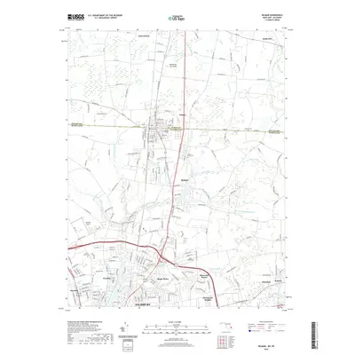
2019 Map of Delmar
USGS Topo · Published 2019About this map
Delmar sits at the heart of the Delmarva Peninsula, straddling the historic boundary between Sussex County, Delaware, and Wicomico County, Maryland. This 2019 survey documents the transition from the southern outskirts of Salisbury to the agricultural reaches of Saint George and Smith Hill. The landscape is defined by the branching tributaries of the North Prong Wicomico River, including Leonard Pond Run and Peggy Br. Local history is preserved in small family and community burial grounds such as the Nichols Family Cem and Oliphant Cem. Aviation history is also present, with Bennett Airport and Ennis Aerodrome serving the region. Residential clusters like Maple Plains, Sherwood Manor, and Chesapeake Heights show the modern expansion of the Salisbury metropolitan area into the surrounding plains.
Find a feature on this map
207 named features on this map. Tap any name to fly to it.
Don’t see what you’re looking for? This feature index may not catch every label — zoom into the map to look around manually.
Map Details
Editions of this 2019 Delmar Map
This is the sole edition of this map. No revisions or reprints were ever made.
Other maps of this area

1901 · Salisbury
USGS Topo · 1:62,500

1902 · Pittsville
USGS Topo · 1:62,500

1915 · Seaford
USGS Topo · 1:62,500

1917 · Millsboro
USGS Topo · 1:62,500

1938 · Millsboro
USGS Topo · 1:62,500

1942 · Eden
USGS Topo · 1:24,000

1942 · Wango
USGS Topo · 1:24,000

1942 · Hebron
USGS Topo · 1:24,000

1942 · Salisbury
USGS Topo · 1:24,000

1942 · Delmar
USGS Topo · 1:24,000