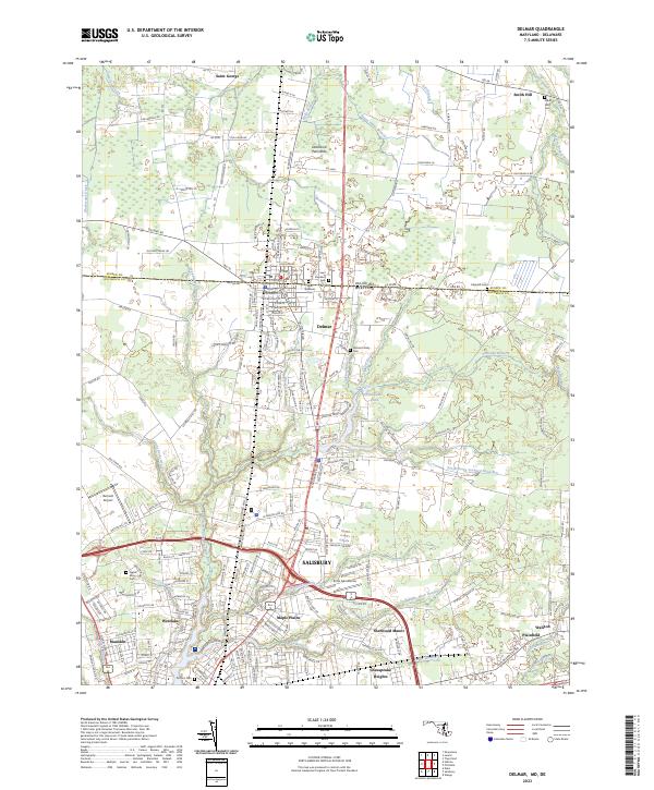
2023 Map of Delmar
USGS Topo · Published 2023About this map
The Delmarva Peninsula serves as the backdrop for this detailed study of the borderlands between Delaware and Maryland. At its heart is the town of Delmar, a unique settlement literally divided by the state line. To the south, the expansion of Salisbury is evident through residential developments like Maple Plains, Westlake, and Chesapeake Heights. The landscape is defined by the headwaters of the North Prong Wicomico River and numerous tributaries such as Leonard Pond Run and Peggy Branch. Genealogists will find significant value in the documentation of several burial grounds, including the Nichols Family Cem, Oliphant Cem, and Saint Stephens Cem. The map also captures critical regional infrastructure, from the Bennett Airport to the Deer's Head Hospital complex, illustrating the modern character of this interstate corridor.
Find a feature on this map
237 named features on this map. Tap any name to fly to it.
Don’t see what you’re looking for? This feature index may not catch every label — zoom into the map to look around manually.
Map Details
Editions of this 2023 Delmar Map
This is the sole edition of this map. No revisions or reprints were ever made.
Other maps of this area

1901 · Salisbury
USGS Topo · 1:62,500

1902 · Pittsville
USGS Topo · 1:62,500

1915 · Seaford
USGS Topo · 1:62,500

1917 · Millsboro
USGS Topo · 1:62,500

1938 · Millsboro
USGS Topo · 1:62,500

1942 · Eden
USGS Topo · 1:24,000

1942 · Wango
USGS Topo · 1:24,000

1942 · Hebron
USGS Topo · 1:24,000

1942 · Salisbury
USGS Topo · 1:24,000

1942 · Delmar
USGS Topo · 1:24,000