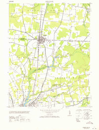
1971 Map of Delmar
USGS Topo · Published 1971About this map
Delmar straddles the boundary between Delaware and Maryland, serving as a dual-state hub centered on the Pennsylvania railroad line. The settlement patterns in the mid-20th century reveal a mix of small crossroads like Five Points and Walston, alongside concentrated institutional development such as the Salisbury Airport and the State Game Farm. To the south, the city of Salisbury begins to emerge along the Wicomico River, where the landscape is characterized by a series of significant water bodies including Johnson Pond and Leonard Pond. The transition from the rural Parsons No. 5 district to the more developed rail corridor highlights the importance of transportation in shaping the Delmarva Peninsula's growth. Geographers and local historians can trace the intricate network of mill branches and ditches, such as Connelly Mill Branch and Figgs Ditch, which supported the region's early drainage and industry.
Find a feature on this map
49 named features on this map. Tap any name to fly to it.
Don’t see what you’re looking for? This feature index may not catch every label — zoom into the map to look around manually.
Map Details
Editions of this 1971 Delmar Map
This is the sole edition of this map. No revisions or reprints were ever made.
Other maps of this area

1901 · Salisbury
USGS Topo · 1:62,500

1902 · Pittsville
USGS Topo · 1:62,500

1915 · Seaford
USGS Topo · 1:62,500

1917 · Millsboro
USGS Topo · 1:62,500

1938 · Millsboro
USGS Topo · 1:62,500

1942 · Eden
USGS Topo · 1:24,000

1942 · Wango
USGS Topo · 1:24,000

1942 · Hebron
USGS Topo · 1:24,000

1942 · Salisbury
USGS Topo · 1:24,000

1942 · Delmar
USGS Topo · 1:24,000